Sustainable Infrastructure Program in Asia
Nature-based solutions for climate resilient infrastructure planning in Indonesia and the Philippines
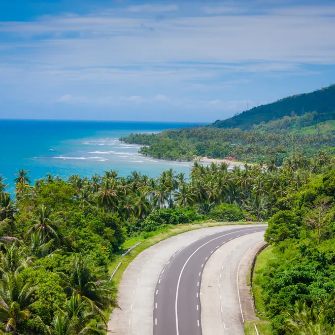
© 2025 Audrius Venclova/Shutterstock
Background
The Sustainable Infrastructure Program in Asia (SIPA) is a collaborative effort between the Organization for Economic Co-operation and Development (OECD) and its consortium partners including WWF. The program helps countries in Central and Southeast Asia plan infrastructure—like enhanced energy systems, transportation, and industry infrastructure—in a way that is better for the environment and supports long-term economic development.
The program provides support to help national and local governments in transitioning their infrastructure systems to meet the Paris Agreement and Sustainable Development Goals (SDG). This includes guidance for the various stages of the infrastructure investment cycle, including strategic planning, project evaluation, policy alignment, and green finance.
Under SIPA, WWF is currently working with the governments of Indonesia and the Philippines to integrate nature-based solutions (NbS)—natural systems or processes used to help achieve societal goals—into transport infrastructure planning. This collaboration involves a nationwide mapping effort to assess priority ecosystem services crucial for climate resilience. These ecosystem services include critical benefits such as water retention and coastal protection that support both road infrastructure and downstream communities. This mapping exercise identifies NbS areas for investment opportunities under scenarios of habitat conservation and land restoration for four ecosystem services: 1) sediment retention, 2) flood mitigation, 3) coastal risk reduction, and 4) water recharge.

Mapping methodology
Conserving existing ecosystems and restoring degraded ones is critical for maintaining and enhancing climate resilience. These efforts that center on nature-based solutions provide essential regulating services that protect people from hazards like flooding and coastal storms. To assist planners and decision makers in implementing these strategies effectively and have the greatest impact, the most promising locations for ecosystem conservation and restoration were identified and involved a comprehensive, data-driven approach.
Advanced mapping models—called InVEST models—were used to evaluate four key ecosystem services: sediment retention, flood mitigation, coastal risk reduction, and water recharge. For example, the analysis included understanding how forests retaining sediments protect downstream populations and road infrastructure, and how flood mitigation can safeguard communities in floodplains.
To ensure these areas are resilient to climate change over the long term, the analyses were taken a step further by modeling each ecosystem service under current and future climate conditions. By extending the analysis to future scenarios, the results revealed specific hotspots of ecosystem service provision that are robust to ongoing climate change. It shows exactly which areas would be best for conservation and restoration to support climate resilience, both at the national and district, and municipal levels in both countries.
We created two basic scenarios answering two questions: what currently forested areas provide these benefits to the most people and roads downstream? Where could we restore currently degraded areas to enhance these benefits for the most people and infrastructure downstream?
SIPA resource hub
Reports
WWF has developed technical reports and policy briefs for Indonesia and the Philippines, summarizing the mapping and analysis of priority nature-based solutions (NbS) that support climate resilience for infrastructure and communities, under conservation and restoration scenarios.
The technical reports detail the modeling approach used by WWF and our partners to identify priority NbS for climate resilience at the national level. Additionally, these reports provide recommendations for mainstreaming NbS in transportation infrastructure planning. The policy briefs are short summaries of these reports, highlighting key results and recommendations.
To provide localized insights, WWF partnered with leading academic institutions—the University of Gadjah Mada in Indonesia and the University of the Philippines Los Baños Foundation Inc. in the Philippines. These collaborations enabled detailed sub-national analyses of key ecosystems that support climate resilience, with a focus on the RIMBA corridor (an ecosystem corridor in Central Sumatra covering Riau, Jambi and West Sumatra in Indonesia) and the Caraga region in the Philippines.
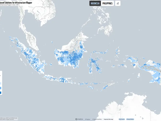
Mapping portal
To showcase the maps generated from the analyses in a user-friendly manner, WWF developed an interactive mapping portal. This portal allows users to view and download the results, along with the methods used to develop them. This feature enables users to recreate the maps as local conditions change.
© WWF