Conservation reboot
Technology is revolutionizing how we protect the planet
By
-
Jen Winger

© BRIAN STAUFFER/WWF-US
From detecting deforestation with remote sensors in Brazil to preventing sea turtle bycatch with LED lights on fishing nets in Indonesia, scientists around the world are harnessing the power of technology to address conservation challenges. WWF is at the forefront of that work, using new tools to monitor species and supply chains, survey and protect habitats, and curb threats to wildlife and people.
Finding solutions to environmental challenges doesn’t always require reinventing the wheel, though. In 2014, WWF launched the Wildlife Crime Technology Project, an initiative designed to prevent the poaching of elephants and black rhinos in Kenya’s Maasai Mara National Reserve. Leaning into his electrical engineering background, WWF conservation engineer Eric Becker helped configure FLIR (forward-looking infrared) thermal cameras to use artificial intelligence to identify people, enabling rangers to spot would-be poachers at night. So far, the cameras have assisted in catching more than 280 poachers, and WWF and FLIR are now expanding the use of thermal technology into 11 Kenyan rhino conservation areas.
But because conservation work often occurs in remote regions, implementing technology on the ground isn’t always easy. “Much of the world is wired, but the field is not,” says Becker. “Vast protected areas have no power and no cell phone coverage.” Creating infrastructure to build secure private networks that can store and process data is often the first step. Once landscapes are outfitted with wireless reception, the real creativity can begin—whether that means identifying innovative, off-the-shelf technology solutions or customizing gadgets to function in the field.
Improving connectivity and facilitating data collection are two ways technology is pushing conservation forward. Sharing information widely and quickly—often in near-real time—is also helping projects scale up like never before. WWF led the development of WILDLABS.net, which has been connecting field-based conservationists with technology experts since 2015. The crowdsourcing platform is a hub of engagement, helping users troubleshoot problems, source technology-enabled solutions, and launch new ideas, such as the latest #tech4wildlife project: a sensor so small that it can literally be deployed on a moth’s back into remote places to collect environmental data.
Throughout our 60-year history, WWF has leveraged technology to tackle global conservation issues and make groundbreaking discoveries. We’ve used satellite collars to discover and track Africa’s longest zebra migration and positioned camera traps to document tigers in Bhutan. We’ve partnered with global tech companies to help them remove or block more than 3.3 million prohibited wildlife listings from online platforms. Our experts have also improved supply chain transparency, making it possible for consumers to trace the journey of wild-caught fish from bait to plate, and have equipped communities with tools to help them preserve their sources of food, water, and livelihoods.
Now, across our network, we’re developing even more ambitious solutions. Read on for our roundup of the fresh tech that’s helping WWF scientists expand their understanding of the natural world and advance conservation.
Protecting wildlife
Solar-powered lights
Technology is shedding new light on the long-standing conflict between pastoralists and lions in Kenya. As humans push into big cat territory, lions have less room to roam and fewer wild prey to hunt. Lions sometimes turn to livestock for an easy meal, stoking discord and prompting retaliation from local communities. In response, WWF and local partners have installed 200 solar-powered LED lights around livestock pens in Narok and Kajiado counties. The lights flicker erratically to imitate human movement and scare off potential predators, keeping livestock—and lions—safer.

© BRIAN STAUFFER/WWF-US
Thermal imaging camera
Roughly 300 rangers patrol Zambia’s 8,600-square-mile Kafue National Park and its nearby lands, home to around 6,500 elephants. In 2019, WWF installed a network of FLIR thermal cameras throughout Lake Itezhi-Tezhi, which borders the park, to intercept—even in the dark—poachers seeking ivory and bushmeat or fishing illegally. When the cameras detect heat emitted by humans, the system transmits video feeds to the rangers. From April to June 2020, Kafue National Park’s FLIR-equipped marine antipoaching unit caught 48 people engaged in illegal activity—a 600% increase in arrests over the previous year.
Surveying and monitoring wildlife
Drones
Approximately 300 black-footed ferrets—one of North America’s most endangered mammals—live in the Great Plains, feeding on prairie dogs and sheltering in their burrows. But both species are highly susceptible to the sylvatic plague, a disease that can swiftly wipe out entire prairie dog colonies. In 2016, a WWF team developed a special dispenser that, attached to a drone, drops edible, peanut butter-flavored vaccine baits onto prairie dog towns. Last year, the US Patent and Trademark Office granted WWF and the US Fish and Wildlife Service a patent for the novel mechanized vaccine delivery system.

© BRIAN STAUFFER/WWF-US
Telemetry
Wildlife tracking technology is not new, but for animals like polar bears, telemetry collars—which collect data in situ—have never been an ideal fit. The devices have a failure rate of 30% to 50% in the Arctic cold, and they can only be used on female bears, whose neck-to-head size ratio keeps collars secure (they fall off male bears). WWF has partnered with global design firm IDEO, product developer MistyWest, and the US Fish and Wildlife Service to explore a new type of unisex satellite telemetry: lightweight ear tags. This year, five polar bears will become the first test subjects for the prototypes.
Environmental DNA
Monitoring wildlife populations is critical to protecting them, but field surveys can be expensive and camera traps can malfunction. Instead, scientists can extract and analyze traces of environmental DNA (eDNA) from water samples to identify aquatic biodiversity in a given region—a process WWF ecologists recently discovered they can also use to detect terrestrial species. In 2021, WWF will use eDNA to locate critically endangered Sumatran rhinos in Kalimantan, Indonesia, in hopes of capturing the species’ remaining individuals for a captive breeding program—one of their last chances for survival.
Surveying and monitoring habitats
Web-based apps
With 90% of reefs on track to experience severe bleaching in the next 50 years, monitoring and collecting data on these vulnerable ecosystems has never been more important. To speed that work, WWF has adopted the Marine Ecological Research and Monitoring Aid, or MERMAID, an open-source, web-based platform that allows researchers to record, analyze, and share their underwater observations quickly and efficiently. Launched in 2019 through a collaboration between WWF and the Wildlife Conservation Society, the application will soon enable scientists to visualize datasets as graphs and maps, facilitating even faster, more informed reef management.

© BRIAN STAUFFER/WWF-US
Remote sensing
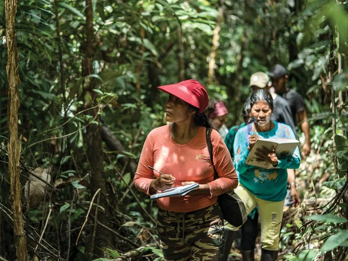
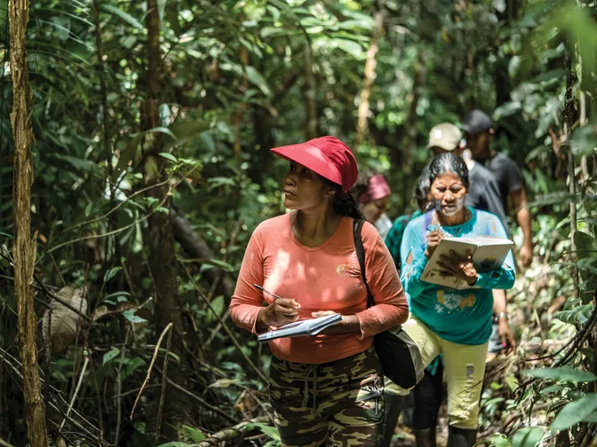
In the western Amazon Basin in Brazil, WWF is equipping the Uru-Eu-Wau-Wau tribe with an efficient way to monitor the rain forest: remote sensing technology-equipped drones. Using these drones, Indigenous communities can patrol larger swaths of forest than they can on foot. The high-resolution images, video, and GPS coordinates the drones generate can be shared with local authorities as evidence of illicit deforestation, such as burning and logging trees to clear land for farming and ranching. WWF has also donated 19 drones to a host of organizations dedicated to halting deforestation in the region.
Machine learning
Remote sensing can detect deforestation already under way, but now experts at WWF-Netherlands, and their partners, are developing technology that can predict it. By feeding big data, such as satellite images, into what’s known as the Early Warning System (EWS), a tech consortium is training machine learning models to identify habitats at risk of illegal logging. The aim is to notify governments and local communities while there’s still time to intervene. EWS is now being piloted in Borneo, where it is forecasting deforestation up to six months in advance with 80% accuracy.
Improving supply chain transparency
Blockchain technology
To increase transparency in the seafood industry, WWF has piloted blockchain technology (a tamper-proof digital ledger) to capture and share the journey of Pacific Island tuna from source to sale. A radio-frequency identification (RFID) tag—containing data about when, where, and how the fish was caught—is affixed to the fish as soon as it’s pulled from the ocean. When the fish is processed, a scannable QR code replaces the RFID tag. Now WWF is going global with its new OpenSC platform that traces the movement of other products along their supply chains.

© BRIAN STAUFFER/WWF-US
Electronic traceability
Traceability is critical to identifying food production practices that are environmentally and socially sound. But in developing nations, which produce most of the planet’s farmed seafood, handwritten documents are the most affordable way to pass information, rendering supply chain transparency a challenge. Enter transparenC: an open-source, cloud-based smartphone app. Farmers, buyers, and businesses can use this free software to prove that a product has been responsibly sourced. WWF is piloting the project with Costco Wholesale Corporation’s farmed shrimp processors in India and Vietnam, but transparenC technology can be applied to any food commodity.
© LUIS BARRETO/WWF-UK
Explore more
Keep reading this issue of World Wildlife magazine