Mapping global rangelands to save vital ecosystems
Rangelands, characterized by grasses, shrubs, and grazeable trees, cover 54% of the planet’s land surface. Millions of people depend on them for their livelihoods and food security, and the deep roots of their native plants store massive amounts of carbon. Despite their significance, only 12% of rangelands are protected; in the early 20th century, humans converted many of the world’s rangelands for their own purposes, from their natural, wild state into settlements and agricultural landscapes, and today land conversion, biodiversity loss, and climate change continue to threaten their health. A new Rangelands Atlas marries conservation case studies, WWF maps, and a wealth of data to raise awareness about these vital ecosystems and sound an alarm for their protection.

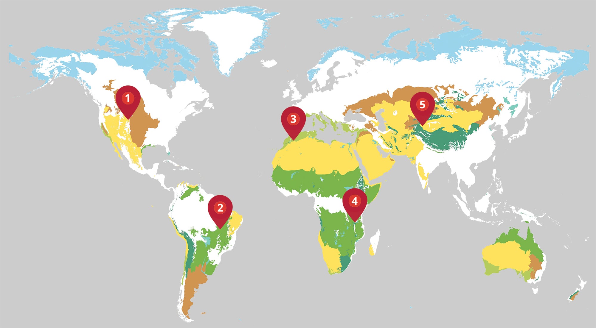
1. United States
Climate change and large-scale industrial farming are eating away at the grasslands of the Northern Great Plains. To help stop the degradation, WWF is working with Native American nations, ranching families, and the US government to halt land conversion and reintroduce culturally and ecologically valuable species like black-footed ferrets and bison.

© CHARLIE SUMMERS/NATUREPL.COM
2. Brazil
The Cerrado, the oldest and most biodiverse savanna rangeland in the world, stores billions of tons of CO2 in complex root systems described as upside-down forests. But only 8% of this land is officially protected. WWF-Brazil partners with local government, civil society organizations, and Indigenous communities, with an aim to protect the Cerrado, promote sustainability, and stop land grabbing and conversion.

© SILAS MIOTTI/WWF-BRAZIL
3. Morocco
Desertification in Morocco has pushed pastoral groups north, creating conflict over a waning amount of rangeland resources. Local pastoral organizations are lobbying for the right to create their own sustainable land management plans and for investment in replanting and soil and water conservation.

© MICHEL GUNTHER/WWF
4. Tanzania
Nearly three-quarters of Tanzania’s land surface is rangeland, where the residents of thousands of villages raise sheep, goats, and cattle—and where cheetahs, elephants, and giraffes roam. Previous policies dictated that each village create its own land-use plan, which fragmented available grazing lands. Villages now come together to agree on plans that benefit everyone.

© JAMES MORGAN/WWF-US
5. Kyrgyzstan
In Kyrgyzstan’s high-altitude rangelands, unsustainable land management practices threaten the livelihoods of herders who tend yaks, sheep, and goats. A recent participatory assessment of rangeland health combined data with input from rarely surveyed herders and found that a return to historic grazing, along with a new understanding of changing climate impacts, could support both the pastoralists and the ecosystem.

© ANDY ISAACSON/WWF-US
© Philippe Oberle / WWF
Explore more
Keep reading this issue of World Wildlife magazine